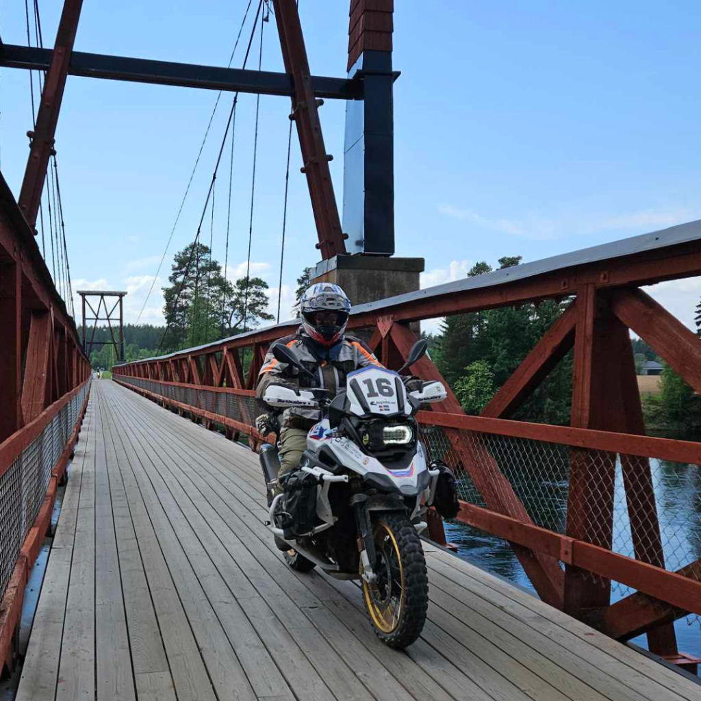
1000 km roadbook written for Adventure Riders – Perfect as a weekend ride – Suggested campsites with accommodation are passed at appropriate intervals
Ride when it suits you at your own pace and stop at nice places along the route – Travel in areas with more bears than people
You don’t have to be an expert on roadbooks to complete this challenge
About the ride
- A roadbook of about 1000 km where you can combine an adventure tour on gravel roads with navigation according using roadbook.
- You choose When to ride, how far to want ro ride each day and who you ride with.
- Campsites where accommodation is recommended will be passed and the distances between them are in the route description that is provided after ordering.
You also get the route as a gpx file so you can switch from the roadbook and reconnect later if you want to add your own loop along the route. - An overall description is included with the distances between refueling, food, rest areas at places of interest and necessary information.
- Fully rideable with overnight accommodation even if there are minor roads.
- This is a gravel trip with a roadbook on nice roads.
- Price: 2450 SEK per person. We release the roadbook to a maximum of 2 parties with a total of a maximum of 5 people per week. Book the dates you want to ride.
Information about the route
- Start and finish location: Hoppbacken at our famaly farm Effersgården in Insjön.
- Maximum of two groups per week with max 3 people per group.
- Total distance: Approx. 1000 km. Exact distance will be announced after test ride during may 2025.
- Longest distance between fuel stations: Exact distance will be announced after the test ride but at most it will be approx. 200 km.
- Number of notes: Announced after test ride.
- Recommended number of riding days: 3-4 days
- Navigation: Only digitally with the RBR roadbookrally app or by gpx.
The Experience
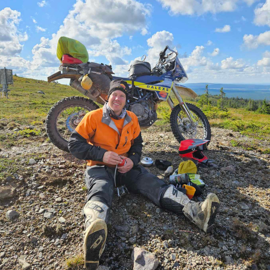
Imagine going on a trip without knowing where you are going and the only thing you know is that you will be riding on nice roads, passing nice places for a coffee break and the entire route is with navigation according to the roadbook!
The tour starts in Insjön but otherwise we will not tell you anything more about the route other than that it will go on varying roads and will probably take you to places you have not visited before. You will be told where you can book accommodation and also get the route as a GPX, but it will be more fun if you do not peek at the route before departure!
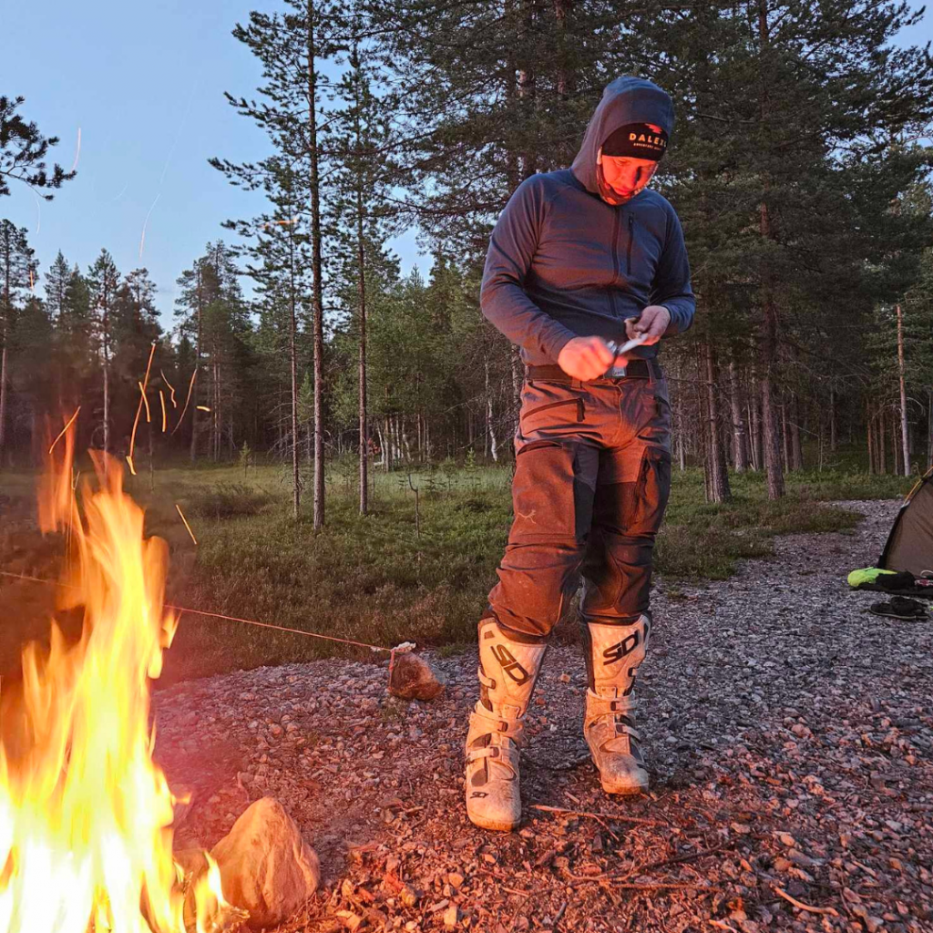
We recommend accommodation in tents at the campsites that are passed but it is also possible to pre-book cabins. In connection with the order, you will receive a route description with contact information for campsites and distances between them so that pre-booking is possible. The route description also contains information about the distance between petrol and where you can buy food.
The notes are written with the background that you will be going on a long trip so we avoid unnecessary notes to fill out the roadbook but it is still clear and the notes are where they are needed.
The roadbook is of a high standard and has been carefully tested. We include clear landmarks in the notes so you get confirmation that you are on the right track.
The local conditions mean that sometimes the notes will be close and sometimes they will be more sparse, and we think you will appreciate the variation.
When ordering, you specify from which date you want access to the roadbook and from that day you have access to the roadbook for 10 days so there is plenty of time to test everything at home before departure.
After ordering, in addition to the route description, you will receive a quick guide to how the app works and how to access the roadbook. The app is currently only available for Android.
The Roadbook
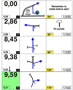
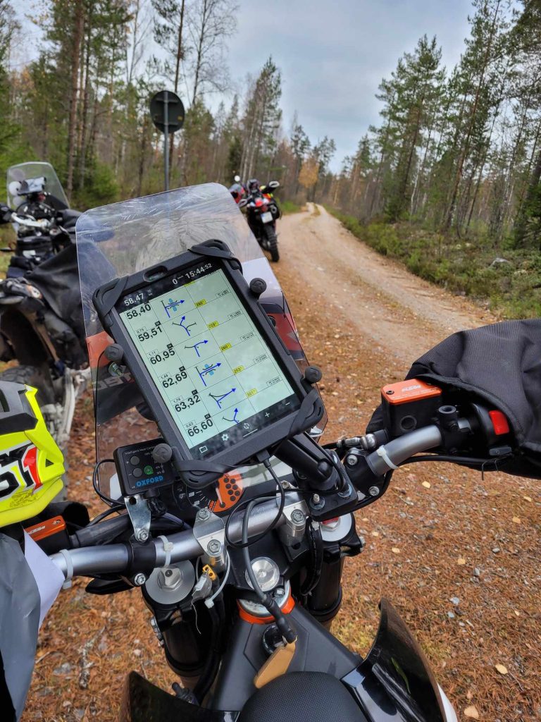
A roadbook describes a route using notes and you use a tripmeter as an aid.
The map image of the note indicates how to continue the journey when the tripmeter matches the distance in the note.
At rallies like Dakar, compass courses and advanced symbols are used, but to navigate on roads, small images of what the road junctions look like are used, and these are called tulips.
When using the RBR app, you can click on the coordinates on the far right in the notes to bring up a map image of where it is. You can then confirm if you are correct or use the map to navigate to the note and continue from there.
If you new to roadbook navigation we help you get started over zoom call.
Code of Conduct
To gain access to the roadbook, you need to confirm compliance with Dalex’s Code of Conduct when ordering.
The app RBR Roadbookrally
To access these roadbooks you need to use the RBR Roadbookrally app and instructions on how it works can be found HERE.
We only share roadbooks in PDF format in exceptional cases.
New to roadbook?
If you new to roadbook navigation we help you get started over zoom call.
Let us know if you have any questions!
Sign up form
We will get back to you by email after registration. You can also use the form to send questions about the tour.
Please read our Code of Conduct and our Purchase Agreement before signing up.
Payment is made by bank transfer and you will receive more information via email after registering your interest.
Starting point
How to navigate by roadbook
What is a roadbook, the long version
A roadbook is a long document that uses notes to describe how to navigate. Each line is a note and you use a trip meter as an aid to measure the distance from the start to each note.
When you start, you have the first note at the top and as you pass the note, you scroll to the next note. The note indicates at what distance you should continue your journey and when the trip meter matches the note’s distance, you navigate as the picture in the note shows.
Each note has three fields and in the field on the left you see the distance from the starting location in large numbers and the distance to the previous note in small numbers.
In the middle you see an image of the location and the road plus the arrow marks how you should continue traveling. The thicker the lines that mark roads, the larger the road in reality.
The field on the far right is for any additional information such as warnings or speed limits.
The roadbook only indicates where to make road changes, so unless the roadbook indicates otherwise, you should follow the main road until the tripmeter shows the same thing as the roadbook and then you are at the mark if you have driven the right way.
If you drive wrong, you turn to the previous mark where everything was correct and adjust the tripmeter to the mark there and then make another attempt.
With the RBR Roadbook Rally app, there is a function where the roadbook scrolls forward automatically when you pass a mark. If you prefer to scroll manually with, for example, a Bluetooth controller from Remotek, this also works well.
Read the manual and the faq that is available at www.roadbookrally.com We can also help you get started over the phone or zoom if necessary, but please try it yourself first.

This is what you need to know before you start
At www.roadbookrally.com you will find a detailed faq that instructs on the functions below.
The trip meter
You need to know how to reset the trip meter, how to manually adjust the trip meter and how to sync the trip meter so that it shows the same thing as the note you are at.
Scroll the roadbook manually
You need to be able to scroll the roadbook forward and backward manually by clicking on the screen or with an external controller if this is used.
How Autoscroll works
You need to know how to start Autoscroll and know that if you scroll the roadbook manually, you must start the function again with Autoscroll.
What to do if you get lost
If you ride the wrong way you turn around and head back to the last note where the roadbook was correct. When you are standing at the location, scroll so that the note you are at is at the top of the screen and then click on the distance in the note. The trip meter should then adjust and show the same distance. If you want to use Autoscroll so that the roadbook scrolls forward by itself, you must activate this by clicking the button at the bottom left again so that Autoscroll turns green.
How to use the coordinates
At the bottom right of the note are the coordinates and if you click on them you will be able to open any map program that will then show you on the map where the note is. This can be used to find a note if you are lost or to confirm that you are standing at the position of the note.
DALEXS philosophy
Creating a route to ride can be done by many, but creating a complete experience with cohesion and added value that you remember with warmth, that is what we strive to create.
The Code of Conduct is the foundation of our activities and it describes how we behave on tour. In short, the Code of Conduct describes how we respect the roads we travel on and the residents in the areas where we move. We want to leave the smallest possible footprint behind us to create a sustainable motorcycle culture on the gravel roads.
Our strength is that you as a participant feel safe both socially and while driving.
The experience should be developing and exciting, so we continuously read the needs of the participants and adapt continuously so that everyone gets the level of excitement that is needed but without exceeding the level.
A non-prestige atmosphere is the key to interesting conversations and honest feedback. We have no need to show off, we want to meet you and create a nice experience.
When the participant rolls home after the tour, it should be with a smile from a nice experience and with new acquaintances, then we have succeeded!